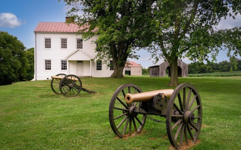
The Best Farm at Monocacy National Battleground
Civil War History Brochures
Learn more about the Civil War in Maryland by exploring historic sites and trails. Trail maps and resources are available to help you journey through the sites that commemorate these historic moments.
The Best Farm at Monocacy National Battleground
At the Crossroads of Conflict
In the spring of 1861, as the Civil War broke out and divided the nation, Maryland braced itself for battle. Living near the Potomac River, the conflict’s pivotal border between North and South, Maryland’s citizens would witness the brutality of the war firsthand. The long clash engulfed homes, towns and livelihoods, leaving its mark here and in the area’s many battlefields. Local citizens, though divided by conviction, were united by compassion. They tended the wounded in nearby small town churches and public buildings, converted into hospitals.
Battles fought on Maryland soil were critical to the defense of the nation’s capital and to the preservation of the Union. Follow the path of history on one of many Civil War driving Trails through sites that commemorate a struggle whose legacy still haunts the nation today.
Order or view Civil War trail maps
A House Divided
During the months leading up to the Civil War, Maryland stood as a house divided. Although it was a slaveholding state, Maryland did not secede. The majority of the population living north and west of Baltimore held loyalties to the Union, while most citizens living on larger farms in the southern and eastern areas of the state were sympathetic to the Confederacy.
On April 19, 1861. just five days after the Union surrendered Fort Sumter, South Carolina, tensions in Baltimore exploded in violence. President Lincoln had ordered Federal troops to move to Washington, D.C. to defend the capital. Baltimore’s Confederate sympathizers attacked Massachusetts soldiers en route along the Pratt Street waterfront. The war’s first casualties fell in Baltimore’s streets.
The Baltimore: A House Divided Civil War Trail is a one-and-a-half mile walking tour that traces the steps of the Massachusetts regiment and the events that led to bloodshed.
Order or view Civil War trail maps
Lee Invades Maryland: The Antietam Campaign
Hoping that a bold invasion of the North would “liberate” Maryland and gain recognition of the Confederacy, General Robert E. Lee, commander of the Confederate Army, pushed through this region in the fall of 1862. The battles that followed were some of the costliest and most decisive of the entire war.
Lee crossed the Potomac into Maryland, hoping to secure supply and communication lines on his way into Pennsylvania. Lee divided his army between Harper’s Ferry, Hagerstown, and the South Mountain gaps.
When the troops at the gaps clashed with the Union, however, Lee was forced to pull back and look for a defensible place to regroup. He chose Sharpsburg. His army stood its ground there and faced the Union at the catastrophic Battle of Antietam on September 17th, 1862 – the single bloodiest day in American history.
Despite the massive losses on both sides, the Union won the day and ended Lee’s invasion, giving President Abraham Lincoln the political leverage necessary to issue the Emancipation Proclamation.
Retrace history along the Antietam Campaign Trail, a driving tour that follows Lee’s advance, his fateful defeat, and the catalyst for the Emancipation Proclamation, which freed the enslaved in Confederate states.
Order or view Civil War trail maps
Explore the Antietam Campaign Byway
Gettysburg Invasion and Retreat
During the summer of 1863, the Confederate Army was again on the move through this region, destined for Pennsylvania. Union forces searched for them in vain, plodding northward from Frederick, just east of South Mountain. Hidden by the mountain ranges, the Confederates marched west of South Mountain through the Great Valley. The two armies finally collided at Gettysburg on July 1, 1963. The battle resulted in another Union victory. Though Gettysburg became known as the “high water mark” of the Confederacy, the United States Army saved the Union once again.
Follow the advance of over 160,000 Union and Confederate troops on the Gettysburg Invasion and Retreat Trails.
Order or view Civil War trail maps
Battle of Monocacy and the Attack on Washington
Maryland was invaded a third time in July of 1864, when Confederate troops under Jubal Early closed in on Washington. The only Union force in their way was a ragtag group of 2300 men, most of whom had never seen battle. Commanded by General Lew Wallace, they spread out over 6 miles along the Monocacy River near Frederick, hoping to stall Early’s army and delay the Confederate advance long enough for the city to bolster its defenses. Though they won the battle, the fight cost the Confederates precious time – and spared the nation's capital.
Just 45 minutes from Washington, the Monocacy National Battlefield demonstrates how close the war came to the capital. Follow Early’s invasion of Maryland and attack on Washington, D.C. on the Attack on Washington: The Last Invasion Trail. The route also follows the paths of Gen. Bradley T. Johnson and Maj. Harry Gilmor, whom Early ordered to move toward Baltimore to cut railroad and telegraph communications, and then to march south to free Confederate prisoners of war at Point Lookout. Strong Union forces turned away Johnson and Gilmor who never reached Point Lookout.
Order or view Civil War trail maps
Chasing Lincoln's Assassin
The Civil War continued for another nine months with military action in the Shenandoah Valley of Virginia, Tennessee, North Carolina, Atlanta, Georgia and the Deep South.
Just days after Gen. Robert E. Lee surrendered at Appomattox Court House, in Virginia, effectively ending the Civil War, President Abraham Lincoln and his wife Mary Todd Lincoln headed to the theatre on the night of April 14, 1865 to relax.
That evening, John Wilkes Booth shot President Lincoln in the back of the head in Ford’s Theatre. Lincoln died in the early hours of April 15, in a back bedroom of Petersen’s Boarding House across the street. Lincoln was able to preserve the Union, but didn’t live long enough to help heal the wounds left by the war.
With a broken leg, Booth fled into Southern Maryland with conspirator David Herold, stopping at Surratt’s Tavern and Dr. Samuel Mudd’s home. Federal troops were in hot pursuit. The pair crossed the Potomac River and ended at Richard Garrett’s farm in Virginia, where troops found them hiding. Here, Booth was shot. Herold stood trial in Washington, D.C. and suffered death on the gallows.
The Theatre where Lincoln was shot and the house where he died are preserved today as Ford’s Theatre National Historic Site.
Follow the route taken by federal authorities as they chased John Wilkes Booth who attempted to escape after assassinating President Lincoln on the John Wilkes Booth: Chasing Lincoln’s Assassin Trail.
Order or view Civil War trail maps
Explore the Chasing Lincoln's Assassin Byway

